Scorching Heat and Stormy Skies Sweep the US: Here’s Today’s Weather Breakdown Across the Country
Heat advisories in effect down South, storm threats loom in the Midwest, while cooler air offers relief elsewhere — here’s your full national weather rundown
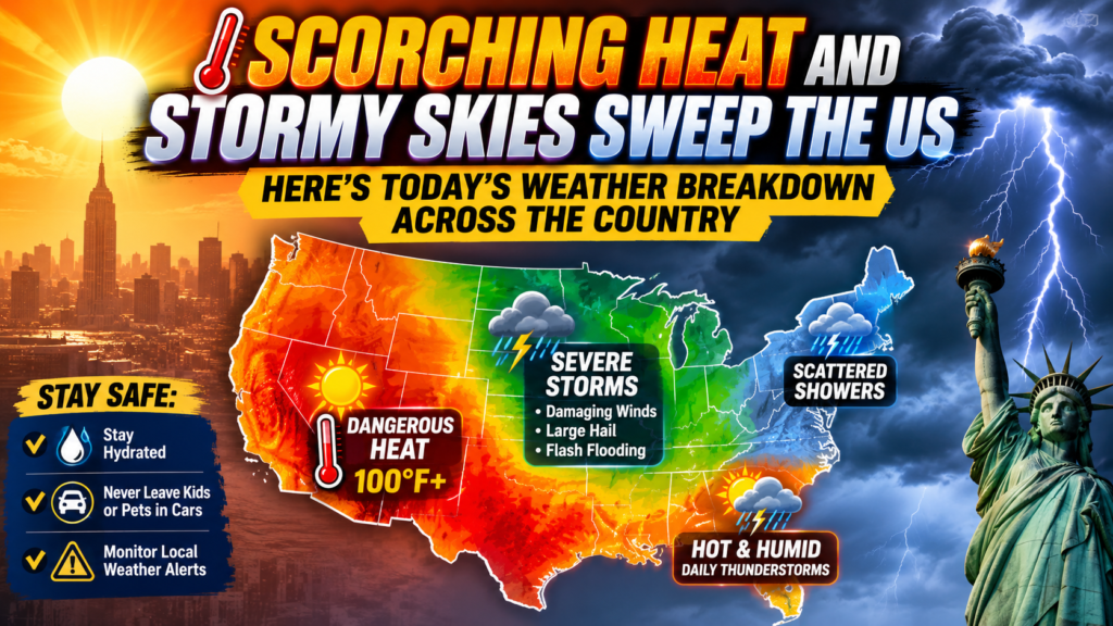
Weather conditions across the United States are painting a strikingly different picture depending on where you look. While southern states are grappling with dangerous heat and oppressive humidity, parts of the Midwest and Northwest are seeing a mix of storm activity, smoke, and scattered rain. Here’s a closer look at what’s happening region by region.
Dangerous Heat Grips the Southeast Coast, Advisories in Effect
Along the coastal stretch of Georgia and South Carolina, particularly around the Savannah area, forecasters have designated today a “First Alert Weather Day.” Temperatures in the region are expected to range between 79 and 99 degrees Fahrenheit, while heat index values closer to the coast could climb as high as 108 to 115 degrees. A Heat Advisory is already active, and forecasters are also watching for the potential of strong to severe thunderstorms south of Interstate 16 during the afternoon hours. The silver lining is that a cold front moving in from the north should eventually bring some relief in the coming days. WTOC-TV
Florida’s Daily Afternoon Storm Pattern Continues
Down in South Florida and the Miami area, the weather pattern has remained fairly consistent — sunny mornings giving way to storms by afternoon. Wednesday is shaping up much like Tuesday, with a dry start across most areas (except the Florida Keys) before afternoon storms roll in, pushing temperatures into the mid-90s. Storm chances are expected to ease slightly heading into Thursday and Friday, though the heat itself isn’t going anywhere anytime soon. NBC 6 South Florida
Tennessee Braces for One Last Heat Spike Before Relief Arrives
In and around Nashville, today could turn out to be the hottest day of the week. Heat index values are expected to feel as high as 105 to 113 degrees, with Heat Alerts remaining in effect until 8:00 p.m. this evening. Local forecasters are urging residents to take heat safety seriously and stay well hydrated. The good news: a cold front is expected to push through overnight, bringing showers and thunderstorms, followed by a noticeably more comfortable and seasonal stretch of weather. NewsChannel 5
Central US Continues to Deal With Muggy Heat, Some Rain Possible
In mid-Missouri, heat and humidity remain the dominant story. Afternoon highs are expected to reach the low 90s, with heat index values nearing 100 degrees. Isolated showers are possible near the Lake of the Ozarks, but most of the region is expected to stay dry, even as cloud cover lingers overhead. Forecasters do expect the heat and humidity to gradually ease by midweek. ABC17NEWS
Wyoming Deals With a Mix of Smoke and Scattered Storms
Out west in Wyoming, conditions look quite different. Wildfire smoke is affecting visibility in several areas, while scattered rain chances add another layer to the forecast. In the Casper area, patchy smoke combined with a slight chance of afternoon rain is expected, though skies will mostly stay sunny with highs near 95 degrees. Towns like Gillette and Newcastle are also bracing for evening storms and gusty winds, which could bring overnight temperatures down noticeably. Cowboy State Daily
A Look Back at the Month: Slightly Warmer Than Average
Zooming out to the bigger picture, July as a whole has run a bit warmer than historical norms across the country. Average temperatures started the month around 30.3°F and gradually dipped to roughly 29.3°F by month’s end, landing about 1.2°F above the historical average overall. The month has also been notably wet, with rainfall and rainy-day counts running above typical levels in many areas. Ease Weather
Looking at individual cities, Texas hotspots like Dallas and Houston have seen some of the highest temperatures this month, while parts of Alaska — including Juneau and Ketchikan — have stayed considerably cooler. Northeastern cities like New York, Philadelphia, and Boston have experienced relatively average conditions, while southern cities such as Atlanta, Orlando, and Miami have continued to feel the brunt of heat and humidity.
Storm Activity Remains a Concern
Alongside the heat, storm and tornado activity hasn’t slowed down much either this summer. On average, hundreds of tornadoes are recorded across the U.S. during June and July, with activity typically concentrated in the Midwest and Great Plains regions. This year has been no exception, with several states under close watch from forecasters, particularly in areas where severe thunderstorms and damaging winds remain a possibility.
Bottom Line
Put simply, the U.S. weather picture right now is a tale of two extremes — dangerous, potentially life-threatening heat is bearing down on much of the South, while storms, smoke, and scattered showers are shaping conditions across the central and western parts of the country. The encouraging news is that cooler air is on the way for several regions, which should bring at least some relief in the days ahead. In the meantime, health officials continue to urge people to stay hydrated, limit time outdoors during peak heat hours, and take heat safety seriously to avoid heat-related illnesses.