US Weather Today: Dangerous Heat Grips the West While Storms Threaten the Central and Eastern US
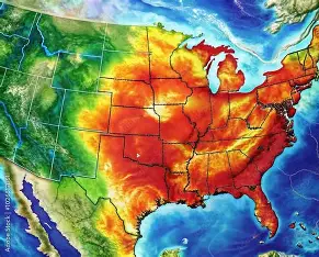
On Sunday, August 2, 2026, weather across the United States is once again making headlines, as conditions in different parts of the country stand in sharp contrast to one another. While the western half of the nation is locked in a punishing heat wave, the central and eastern regions are bracing for heavy rain and severe thunderstorms. Meteorologists say the extreme conditions out west are being driven by a powerful “heat dome” that has parked itself over the region, pushing temperatures to dangerous levels.
Record-Breaking Temperatures in the West
The heat dome sitting over the western U.S. is strong enough that several areas are flirting with all-time temperature records. Death Valley is forecast to hit around 126 degrees Fahrenheit (roughly 52 degrees Celsius), making it the hottest reading anywhere in the country during this heat wave. Billings, Montana, was expected to reach 106 degrees Fahrenheit on Saturday — a mark that, if confirmed, would set a new August record for the city.
Salt Lake City is forecast to see nearly identical numbers, while Phoenix, Tucson and Las Vegas are all expected to climb well above 110 degrees Fahrenheit. Forecasters estimate that by August 4, roughly 10 percent of the continental United States will have recorded its hottest day of 2026 so far.
Extreme Heat Warnings in Las Vegas
The National Weather Service office in Las Vegas has issued Extreme Heat Warnings and Heat Advisories for southern Nevada, cautioning that both daily and monthly temperature records could be broken in the coming days. The warning underscores just how dangerous the coming stretch could be for residents — particularly the elderly, young children, and anyone working outdoors.
A Troubling Toll From the Heat
Maricopa County, Arizona, has confirmed 40 heat-related deaths so far this year. A separate analysis found that at least 70 deaths across the country were linked to heat domes during the month of July alone — a number notably higher than the totals reported through official state-by-state counts. These figures highlight how relentless summer heat has become far more than an inconvenience; it now represents a serious and growing public health challenge.
Storms and Flooding Threaten the Central and Eastern US
While the West bakes under extreme heat, forecasters have issued warnings for heavy rain and severe weather across the central and eastern parts of the country. The Weather Prediction Center has placed a Slight Risk of excessive rainfall from the Upper Midwest through the Mid-Mississippi and Ohio valleys. At the same time, a Slight Risk of severe thunderstorms is in effect for the Mississippi Valley and the Ozarks, with the potential for damaging winds, isolated hail and even a few tornadoes.
Meanwhile, monsoon moisture over the Four Corners region is fueling afternoon and evening thunderstorms that began Saturday and are expected to continue. Forecasters are particularly concerned about slow-moving storms, which raise the risk of flash flooding — especially in areas where the ground is already saturated and unable to absorb additional rainfall.
A Snapshot of Major Cities Today
According to Sunday’s forecast, weather conditions across several major U.S. cities looked like this:
- Albany, New York is expecting a stray afternoon thunderstorm, along with notably high humidity levels.
- Albuquerque, New Mexico could see isolated storm showers, with temperatures climbing to around 97 degrees Fahrenheit.
- Asheville, North Carolina is under a forecast for thunderstorms throughout the day.
- Atlanta, Georgia is expected to see showers and thunderstorm activity, with highs around 85 degrees Fahrenheit.
- Austin, Texas will stay hot and mostly sunny, with temperatures reaching as high as 101 degrees Fahrenheit.
- Baltimore, Maryland is under a warning for a heavy thunderstorm.
- Baton Rouge, Louisiana is expected to see continued shower and thunderstorm activity through the day.
These conditions illustrate just how different the weather picture looks depending on where you are in the country — dry, scorching heat dominates the Southwest, while humidity and stormy conditions are taking hold across the South and East Coast.
A Growing Wildfire Risk
Alongside the extreme heat, wildfire risk continues to climb across the western U.S. As monsoon activity eases and the heat dome strengthens, the region could see an uptick in dry lightning strikes, which — combined with parched vegetation and intense heat — can quickly spark new wildfires. Just recently, thousands of lightning strikes in Oregon alone triggered multiple wildfires, and forecasters warn that risk could intensify further in the days ahead.
What Comes Next
Meteorologists expect the heat dome to maintain its grip over the western states for at least the next several days, meaning the current heat wave is unlikely to break anytime soon. Meanwhile, stormy conditions across the central and eastern U.S. are expected to persist as well, requiring local officials to stay alert to ongoing flood and severe weather risks.
The National Weather Service and other forecasting agencies continue to urge residents to stay informed about local weather alerts, drink plenty of water during periods of extreme heat, limit outdoor activity when possible, and avoid unnecessary travel in storm-affected areas. Between the extreme heat out west and the stormy weather elsewhere, conditions across the country are currently affecting daily life in very different ways — and staying updated on local forecasts remains essential in the days ahead.
This is a weather report based on current forecasts. Conditions can change rapidly, so readers should check with their local weather service or official sources for the latest updates in their area.