US Weather Today: Extreme Heat, Powerful Storms, and Flash Flood Threat Across America
US Weather Today:
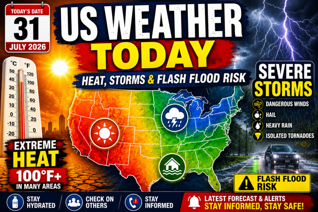
As the United States enters the final day of July, weather conditions remain highly active across much of the country. Millions of Americans are dealing with dangerous summer heat, while others are preparing for severe thunderstorms capable of producing damaging winds, large hail, heavy rainfall, and localized flash flooding.
Weather experts say a strong area of high pressure continues to dominate the central and southern United States, allowing hot air to remain trapped over the region. At the same time, cooler air moving southward is colliding with warm, moisture-filled air, creating the perfect setup for powerful thunderstorms across several northern and eastern states.
Dangerous Heat Continues Across Southern States
The biggest weather concern today remains the ongoing heat wave affecting the southern half of the country. States including Texas, Oklahoma, Louisiana, Arkansas, Mississippi, Arizona, and New Mexico are expected to experience afternoon temperatures ranging from the upper 90s to well above 100 degrees.
Humidity is making conditions even more uncomfortable, with the heat index climbing several degrees higher than the actual air temperature. In many communities, it may feel hotter than 105°F, increasing the risk of heat-related illnesses.
Health officials recommend limiting outdoor activities during the hottest part of the day, drinking plenty of water, wearing lightweight clothing, and checking on elderly family members and neighbors who may be more vulnerable to extreme temperatures.
Texas Sees a Change in Weather Pattern
Although much of Texas remains under intense summer heat, a weak cold front is expected to move through portions of the state, bringing scattered thunderstorms and slightly cooler temperatures.
Northern and Central Texas have the greatest chance of seeing thunderstorms during the afternoon and evening hours. Some of these storms could become severe, producing strong wind gusts, hail, frequent lightning, and brief periods of heavy rainfall.
While the cooler air may provide temporary relief, meteorologists emphasize that summer heat will quickly return after the front passes.
Strong Thunderstorms Expected Around the Great Lakes
Another major weather concern today is centered over the Great Lakes region.
Warm, humid air interacting with an approaching weather system is expected to trigger widespread thunderstorms across parts of Wisconsin, Michigan, Illinois, Indiana, Ohio, and nearby states.
Several storms may become severe enough to produce damaging straight-line winds, hail, intense lightning, and isolated tornadoes. Heavy rainfall could also reduce visibility for drivers and increase the risk of localized flooding in urban areas.
Residents are encouraged to remain alert throughout the day and monitor weather updates if severe thunderstorm warnings are issued.
Southwest Continues to Experience Extreme Summer Heat
The Desert Southwest remains one of the hottest parts of the country.
Arizona, Nevada, southeastern California, and portions of New Mexico are once again expected to record temperatures exceeding 105°F. Some desert communities may even approach 115°F during the hottest hours of the afternoon.
Another concern is the unusually warm nighttime temperatures, which provide little opportunity for homes and buildings to cool down naturally. This can increase the health risks associated with prolonged heat exposure.
Humid Conditions Across the Midwest
Across much of the Midwest, temperatures remain warm while high humidity makes outdoor conditions feel even hotter.
Afternoon heat index values are expected to exceed 100°F in several locations. This warm, moisture-rich atmosphere also increases the likelihood of afternoon thunderstorms capable of producing heavy downpours and gusty winds.
Although not every community will experience storms, isolated thunderstorms may develop quickly and become locally intense.
Heavy Rain May Trigger Flash Flooding
Several regions remain at risk of receiving repeated rounds of thunderstorms capable of producing significant rainfall in a short period.
Areas with poor drainage, low-lying neighborhoods, and locations near small rivers and creeks could experience localized flash flooding if storms repeatedly move over the same area.
Drivers should never attempt to cross flooded roadways, as even shallow moving water can become extremely dangerous.
Travel Conditions May Be Affected
Weather conditions today may disrupt travel across several parts of the United States.
Thunderstorms could cause delays at major airports, while heavy rain and reduced visibility may create hazardous driving conditions on highways.
Extreme heat may also increase electricity demand as millions of homes continue relying heavily on air conditioning, placing additional pressure on regional power systems.
Travelers are encouraged to check airline schedules and local weather forecasts before beginning their journeys.
Weather Safety Tips
With both extreme heat and severe storms affecting different parts of the country, weather officials recommend several important safety measures:
- Stay hydrated throughout the day.
- Avoid prolonged outdoor activity during peak afternoon heat.
- Wear light-colored, breathable clothing.
- Never leave children or pets inside parked vehicles.
- Move indoors immediately when thunder is heard.
- Stay informed by monitoring official weather alerts.
- Avoid driving through flooded roads.
- Keep emergency supplies, flashlights, and charged mobile devices available in case of power outages.
Following these precautions can help reduce the risk of weather-related emergencies.
Weather Outlook for the Coming Days
Looking ahead, much of the southern United States is expected to remain hotter than average as the calendar turns to August. While a few locations may briefly cool following passing weather systems, widespread summer heat is likely to continue.
Meanwhile, active storm systems will continue moving across the northern United States and Great Lakes region, bringing additional opportunities for thunderstorms and periods of heavy rainfall over the next several days.
Meteorologists expect this pattern of hot conditions in the South and frequent storm development farther north to remain in place into early August.
Conclusion
Today’s weather highlights the wide variety of summer conditions currently affecting the United States. Dangerous heat continues across the South and Southwest, while powerful thunderstorms threaten parts of the Great Lakes, Midwest, and Texas with damaging winds, hail, and heavy rainfall.
Whether facing scorching temperatures or severe storms, residents are encouraged to remain weather-aware, follow official forecasts, and take necessary precautions to protect themselves and their families. Staying informed and preparing ahead can make a significant difference during periods of active summer weather.